By Sylvia Okoi
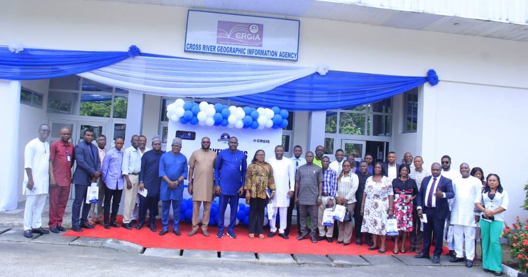
The Cross River State Geographic Information Agency recently hosted a stakeholders meeting to discuss the Geographic Information System (GIS) Project, marking a significant step towards the socio-economic development of the State, assuring attendees that the system will be inclusive and user-friendly.
Speaking during the opening ceremony, the Director General of the Cross River Geographic Information Agency, Mr. William Archibong, maintained that the agency has evolved beyond traditional land administration, that with the support of the State Governor, Sen. Bassey Edet Otu, the agency has been overhauled to include advanced technical software, leading to the development of the GIS Project.
Mr. Archibong highlighted the benefits of the GIS Project, noting that Geographic Information Systems are gaining global acceptance, stressing that for Cross River State to advance economically, all Ministries, Departments, and Agencies (MDAs) must adopt GIS to ensure streamlined documentation and improved tracking of implementation activities, ultimately facilitating informed decision-making for a robust state economy.
READ ALSO: Anglican Bishop Calls for National Rebirth, Commends C’River Progress under Gov Otu
He urged both public and private sector stakeholders to provide essential data that will be stored and utilized to enhance State services.
Also speaking, the Vice Chairman of the State Planning Commission, Pastor Bong Duke, reiterated the importance of the GIS Project, which aims to address issues related to inefficient land management, inadequate land records, and outdated manual processes that have historically hindered the state’s progress.
Pastor Duke called for stakeholder engagement, emphasizing that the project requires collaborative input to succeed, noting that accurate and transparent land records will become more accessible through the GIS Project.
He urged them to partner with the Cross River Geographic Information Agency to ensure the project is successfully implemented, stating that its success will not only improve governance but also unlock investment opportunities, enhance security, and promote overall socio-economic growth in the State.
In his multi media presentation outlining the CRGIS Project, Project Coordinator Mr. Jesam Iwara explained that the initiative aims to enhance information accessibility for Cross River State by storing historical data that will inform the state’s past, present, and future, describing the project as an online tool that integrates people, data, hardware, and software.
“The project transcends a simple mapping tool; it serves as a decision-making instrument for various industries and the public sector to analyze trends in education, agriculture, health, and the environment, following thorough data analysis,” Mr. Iwara added.
He asserted that the GIS Project will enable the State to transition from a reactive to a proactive approach, potentially mitigating challenges such as flooding and disease outbreaks through full project implementation.
In his remarks, Surveyor Solomon Nsor shared insights on the support provided by NUGI Technologies for the GIS project, detailing that Nugitech has developed a digital process for land processing, customized GIS applications tailored to project demands, staff training on the software for improved efficiency, an integrated payment system for MDAs, and geospatial data design, explaining that citizens will have access to vital information needed to develop strategic policy frameworks.
In their responses, stakeholders expressed enthusiasm about the project, anticipating its benefits for their respective MDAs.
The Stakeholders Engagement brought together, Members of the State Executive Council, Technocrats, Academia, Director General of Agencies, Statisticians led by the Statiscian General of the State as well as participants from the Private Sector.